SubFamily: AMPHIPEPLEINAE - Genus: Austropeplea B.C. Cotton, 1942 (syn: Kutikina - DB: 2 SP, 1 IMG)
|
|
SubFamily: AMPHIPEPLEINAE - Genus: Bullastra L.S.R. Bergh, 1901 (DB: 1 SP, 0 IMG)
|
SubFamily: AMPHIPEPLEINAE - Genus: Lantzia F.P. Jousseaume, 1872 (DB: 1 SP, 0 IMG)
|
SubFamily: AMPHIPEPLEINAE - Genus: Limnobulla N.D. Kruglov & Y.I. Starobogatov, 1985 (DB: 1 SP, 0 IMG)
|
SubFamily: AMPHIPEPLEINAE - Genus: Myxas W.E. Leach in G.B. Sowerby, 1822 (syn: Amphipeplea, Lutea, Myxus - DB: 7 SP, 2 IMG)
|
|
|

|
|
7154000268
Myxas
buchii
(FOSSIL)
(K.E.I. von Eichwald,
1830 †)
|
|
No Georeferenced data available
|
|
|
|
|
|
|
|
|
7154000269
Myxas
hidasensis
(FOSSIL)
Csepreghy-Meznerics,
1950 †
|
|
No Georeferenced data available
|
|
|
|
|
|
|
|
|
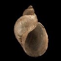
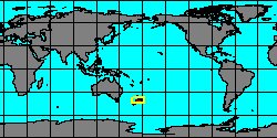
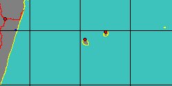
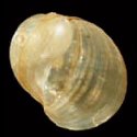
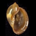
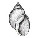
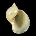
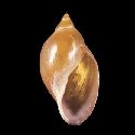
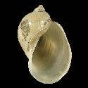
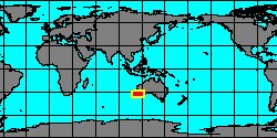
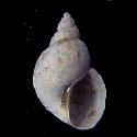
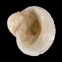
3631700340
Myxas
lessoni
G.P. Deshayes, 1830
West Australia, Freemantle
18 mm
|
|
|
|
|
|
|
SubFamily: AMPHIPEPLEINAE - Genus: Orientogalba N.D. Kruglov & Y.I. Starobogatov, 1985 (syn: Lenagalba - DB: 1 SP, 0 IMG)
|
SubFamily: AMPHIPEPLEINAE - Genus: Pacifimyxas N.D. Kruglov & Y.I. Starobogatov, 1985 (DB: 1 SP, 0 IMG)
|
SubFamily: AMPHIPEPLEINAE - Genus: Pectinidens H.A. Pilsbry, 1911 (DB: 1 SP, 1 IMG)
|
|
|
|
|
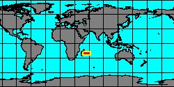
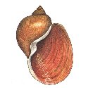
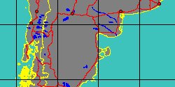
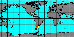
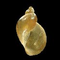
5598000006
Pectinidens
diaphanus
(P.P. King in P.P. King
& W.J. Broderip, 1832)
Argentina, Santa Cruz
11 mm
|
|
|
|
|
SubFamily: AMPHIPEPLEINAE - Genus: Radix P.D. Montfort, 1810 (syn: Auriculariana, Cyclolimnea, Gulnaria, Limnosiana, Neritostoma - DB: 79 SP, 30 IMG)
|
|
|
|
|
|
7154000418
Radix
alta
(FOSSIL)
Macale?, 2000 †
|
|
No Georeferenced data available
|
|
|
|
|
|
|
|
7154000282
Radix
alutae
(FOSSIL)
(E. Jekelius, 1932 †)
|
|
No Georeferenced data available
|
|
|
|
|
|
|
|
7154000283
Radix
amaradica
(FOSSIL)
Macale?, 2000 †
|
|
No Georeferenced data available
|
|
|
|
|
|
|
|
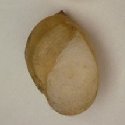
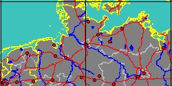
3631700380
Radix
ampla
J.D.W. Hartmann, 1821
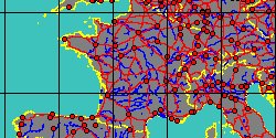
Germany, Hamburg
|
|
|
|
|
|
|
|
|
|
|
|
|
|
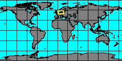
5602000147
Radix
bactriana
(T.N. Annandale
& B. Prashad, 1919)
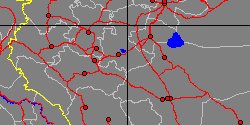
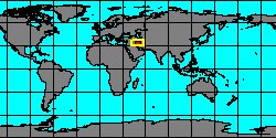
Iran, Markazi Province
|
|
|
|
|
|
|
|
|
|
7154000284
Radix
balatonica
(FOSSIL)
(A. Fuchs, 1870 †)
|
|
No Georeferenced data available
|
|
|
|
|
|
|
|
|
|
7154000286
Radix
bogdanensis
(FOSSIL)
Macale?, 2000 †
|
|
No Georeferenced data available
|
|
|
|
|
|
|
|
|
|
7154000288
Radix
croatica
(FOSSIL)
(Gorjanovic-Kramberger, 1890 †)
|
|
No Georeferenced data available
|
|
|
|
|
|
|
|
7154000289
Radix
cucuronensis
(FOSSIL)
(C.F. Fontannes, 1878 †)
|
|
No Georeferenced data available
|
|
|
|
|
|
|
|
|
7154000302
Radix
dilleri
(FOSSIL)
(M. von Neumayr, 1883 †)
|
|
No Georeferenced data available
|
|
|
|
«
Previous
1
2
3
4
5
6
7
8
9
10
11
12
13
Next
»
|
|
| | | | | | | |