SubFamily: ANNULARIINAE - Subgenus: Tudora (Wrightudora) C. de la Torre & P. Bartsch, 1941 (DB: 18 SP, 1 IMG)
|
|
|
|
|
|
|
|
|
|
|
|
|
|
|
SubFamily: ANNULARIINAE - Genus: Weinlandipoma P. Bartsch, 1946 (DB: 7 SP, 2 IMG)
|
|
|
|
|
|
|
|
SubFamily: CYCLOTOPSINAE - Genus: Cinnabarica E. Neubert, 2009 (DB: 3 SP, 3 IMG)
|
|
|
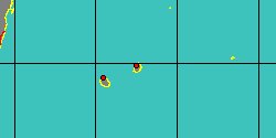
SubFamily: CYCLOTOPSINAE - Genus: Cyclotopsis W.T. Blanford, 1864 (DB: 15 SP, 11 IMG)
|
|
|
|
|
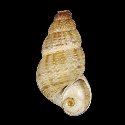
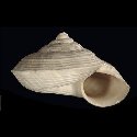
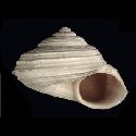
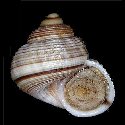
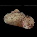
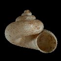
5220000595
Cyclotopsis
beviae
(E. Fischer-Piette, Ch.P. Blanc, F. Blanc
& F. Salvat, 1993)
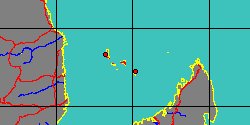
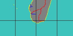
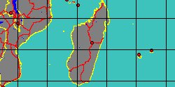
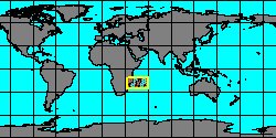
South Madagascar
13,4 mm
|
|
|
|
|
|
|
|
|
|
|
|
|
|
|
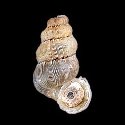
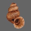
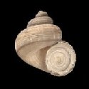
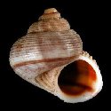
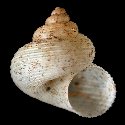
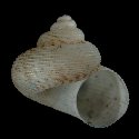
5220000593
Cyclotopsis
mermosi
(E. Fischer-Piette, Ch.P. Blanc, F. Blanc
& F. Salvat, 1993)
Madagascar, Tulear
8 mm
|
|
|
|
|
|
|
|
|
|
5220000594
Cyclotopsis
miaryi
(E. Fischer-Piette, Ch.P. Blanc, F. Blanc
& F. Salvat, 1993)
Madagascar
11,5 mm
|
|
|
|
|
|
|
«
Previous
1
2
3
4
5
6
7
8
9
10
11
12
13
14
15
16
17
18
19
20
21
22
23
24
25
26
27
28
Next
»
|
|
| | |