Genus: Atomiscala De Boury, 1909 (DB: 2 SP, 1 IMG)
|
|
Genus: Bouryiscala A.E.M. Cossmann, 1902 (syn: Dissopalia - DB: 1 SP, 0 IMG)
|
Genus: Camponaxis Bandel, 1995 † (DB: 8 SP, 3 IMG)
|
|
|
|
|
|
|
|

|
|
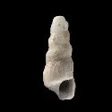
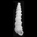
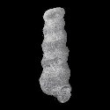
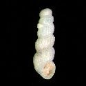
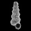
5366000151
Camponaxis
ponderi
(FOSSIL)
S. Kiel & K. Bandel,
2003 †
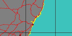
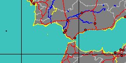
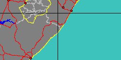
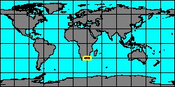
South Africa, Umzamba River Mouth
|
|
|
|
|
|
|
Genus: Coenaculum T. Iredale, 1924 (syn: Parascala - DB: 4 SP, 1 IMG)
|
|
|
|
|
|

|
|
5350000003
Coenaculum
weerdtae
R.G. Moolenbeek
& M.J. Faber, 1992
|
|
No Georeferenced data available
|
|
|
Genus: Conusella Grundel, 1999 † (DB: 2 SP, 0 IMG)
|
|
|
|
|
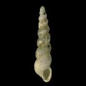
5366000154
Conusella
conica
(FOSSIL)
Grundel, 1999 †
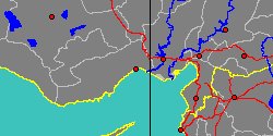
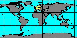
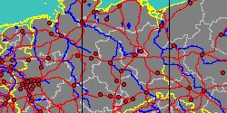
Germany, Mecklenburg-Vorpommern,
Vorpommern-RCLgen
|
|
|
|

|
|
|
|
|
|
5366000155
Conusella
convexa
(FOSSIL)
Schulbert & A. Nützel,
2013 †
|
|
No Georeferenced data available
|
|
|
Genus: Cristalloella Bandel, 1995 † (DB: 4 SP, 2 IMG)
|
|
|
|
|
|
|
|
5366000159
Cristalloella
parva
(FOSSIL)
K. Bandel & al., 2000 †
|
|
No Georeferenced data available
|
|
|
Subgenus: Cristalloella (Wonwalica) Schröder, 1995 † (DB: 5 SP, 3 IMG)
|
|
|
|
|
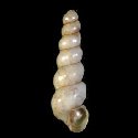
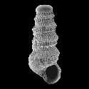
5366000160
Wonwalica
bandeli
(FOSSIL)
Grundel, 2007 †
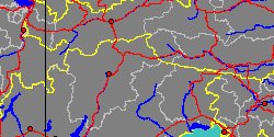
Germany, Sachsen-Anhalt, Stendal
|
|
|
|
|
|
|
|
|
|
|
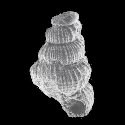
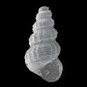
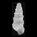
5366000162
Wonwalica
minuta
(FOSSIL)
(F. Schröder, 1995 †)
Poland, Mazowsze
1,2 mm
|
|
|
|
|
|
|
|
|
|
5366000163
Wonwalica
pusilla
(FOSSIL)
Grundel, 2006 †
|
|
No Georeferenced data available
|
|
|
|
|
|
|
|
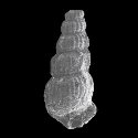
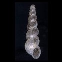
5366000164
Wonwalica
sinuata
(FOSSIL)
(K. Bandel, 1995 †)
Italy, St Cassian Formation
1,4 mm
|
|
|
|
|
Genus: Graphis J.G. Jeffreys, 1867 (syn: Cioniscus, Miraclis, Pseudochemnitzia, Rotfanella - DB: 26 SP, 9 IMG)
|
|
|
|
|
|
2170050016
Graphis
ambigua
(N.E. Weisbord, 1962)
|
|
No Georeferenced data available
|
|
|
|
|
|
|
|
|
|
2170050017
Graphis
eikenboomi
J. van der Linden
& R.G. Moolenbeek, 2004
|
|
No Georeferenced data available
|
|
|
|
|
|
|
|
6628000008
Graphis
eocenica
(FOSSIL)
M.E.A. de Boury, 1887 †
France, Paris Basin
|
|

|
|
|
|
|
|
|
|
6628000009
Graphis
eugenii
(FOSSIL)
(G.P. Deshayes, 1861 †)
France, Paris Basin
|
|
|
|
|
|
|
|
|
|
|
5366000165
Graphis
herrigi
(FOSSIL)
Grundel, 1999 †
Germany, Sachsen-Anhalt
|
|
|
|
|
|
« Previous 1
2
Next
»
|
|
| | | | | | |