Genus: Thaluta G. Rosenberg & P. Callomon, 2003 (DB: 2 SP, 2 IMG)
|
Genus: Tosapusia M. Azuma, 1965 (syn: Tongsuapusia - DB: 11 SP, 10 IMG)
|
|
|
|
|
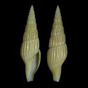
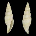
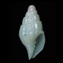
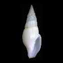
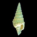
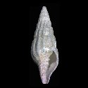
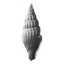
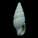
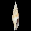
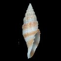
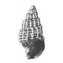
6526000053
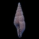
Tosapusia
bismarckeana
A.E. Fedosov, M. Herrmann
& P. Bouchet, 2017
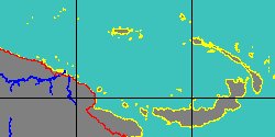
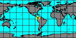
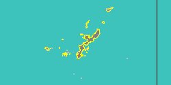
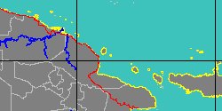
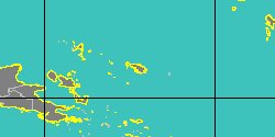
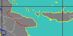
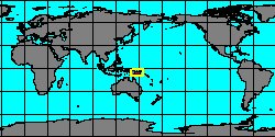
Papua New Guinea, Bagabag Island
35,1 mm
|
|
|
|
|
|
|
|
|
|
|
|
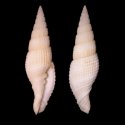
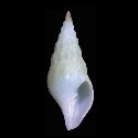
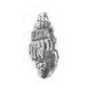
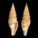
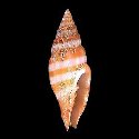
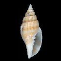
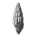
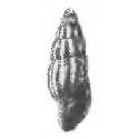
2070454855
Tosapusia
isaoi
(J.T. Kuroda
& K. Sakurai, 1959)
Japan, Tosa Bay
57,6 mm
|
|
|
|
|
|
|
|
|
|
|
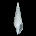
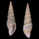
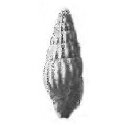
2070456560
Tosapusia
kurodai
(K. Sakurai & T. Habe,
1964)
Philippines, Balicasag Island
32,3 mm
|
|
|
|
|
|
|
|
|
|
6526000054
Tosapusia
longirostris
A.E. Fedosov, M. Herrmann
& P. Bouchet, 2017
Philippines, Luzon Island
22,3 mm
|
|
|
|
|
|
|
|
|
|
6526000055
Tosapusia
myurella
A.E. Fedosov, M. Herrmann
& P. Bouchet, 2017
Papua New Guinea, Woodlark Island
29,1 mm
|
|
|
|
|
|
|
|
|
|
|
|
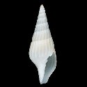
6526000057
Tosapusia
vitiaz
A.E. Fedosov, M. Herrmann
& P. Bouchet, 2017
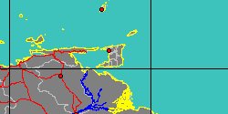
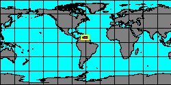
Papua New Guinea, Vitiaz strait
34,3 mm
|
|
|
|
|
Genus: Turricostellaria E.J. Petuch, 1987 (DB: 6 SP, 6 IMG)
|
|
|
|
|
|
Genus: Uromitra Bellardi, 1887 † (DB: 26 SP, 15 IMG)
|
|
|

|
|
5346000280
Uromitra
antegressa
(FOSSIL)
L.M.D. Bellardi, 1887 †
|
|
No Georeferenced data available
|
|
|
|
|
|
|
|
|
5346000310
Uromitra
bristoli
(FOSSIL)
C.J. Maury, 1925 †
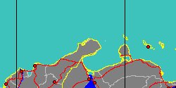
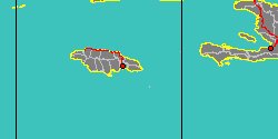
Trinidad and Tobago,
Couva-Tabaquite-Talparo
|
|
|
|
|
|
|
|
|
|
|
|
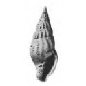
6526000026
Uromitra
climax
(FOSSIL)
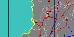
J. Gardner, 1938 †
Florida, Alum Bluff formation
6,3 mm
|
|
|
|

|
|
|
|
|
|
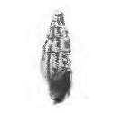
6526000030
Uromitra
cnestum
(FOSSIL)
J. Gardner, 1937 †
Florida, Alum Bluff formation
6,1 mm
|
|
|
|
|
|
|
|
|
|
|
|
|
|
|
6526000029
Uromitra
hamadryas
(FOSSIL)
J. Gardner, 1937 †
Florida, Alum Bluff formation
5,5 mm
|
|
|
|
|
|
|
|
|
|
|
|
|
6526000032
Uromitra
mikkulum
(FOSSIL)
J. Gardner, 1937 †
Florida, Alum Bluff formation
4,9 mm
|
|
|
|
|
|
«
Previous
1
2
3
4
5
6
7
8
9
10
11
12
13
14
15
16
17
18
Next
»
|
|
| | |