Genus: Cosa H.J. Finlay, 1926 (syn: Denticosa - DB: 35 SP, 4 IMG)
|
|
|

|
|
7040000011
Cosa
pileata
(K.H.J. Thiele
& S.G.A. Jaeckel, 1931)
|
|
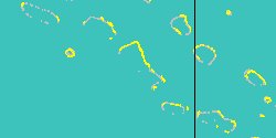
No Georeferenced data available
|
|
|
|
|
|

|
|
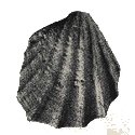
7444000037
Cosa
praeuntia
(FOSSIL)
(Tate 1898) †
|
|
No Georeferenced data available
|
|
|
|
|
|
|
|
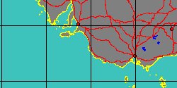
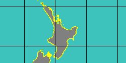
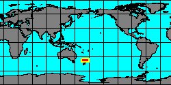
5330400035
Cosa
sagana
T. Iredale, 1931
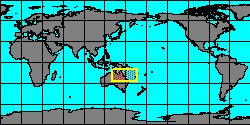
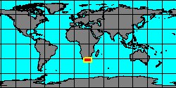
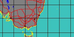
New South Wales
|
|
|
|
|
|
|
|
|
|
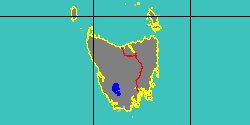
5330400040
Cosa
scabra
(C. Hedley, 1906)
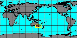
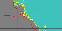
Australia, Mast Head Island
|
|
|
|
|
|
|
|
|
|
|
|
|
|
|
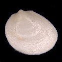
7040000013
Cosa
tholiata
P.G. Oliver
& A.M. Holmes, 2004
Mauritius, Rodriguez Island
|
|

|
|
|
|
|
|
|
|
7444000021
Cosa
trigonopsis
(FOSSIL)
(F.W. Hutton, 1885 †)
|
|
No Georeferenced data available
|
|
|
|
|
|
|
|
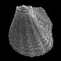
7040000014
Cosa
uchimae
I. Hayami & T. Kase, 1993
|
|
No Georeferenced data available
|
|
|
|
|
|
|
|
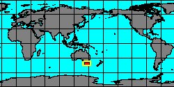
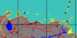
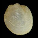
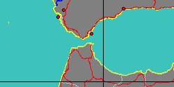
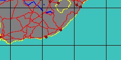
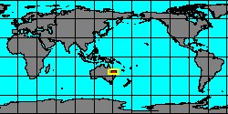
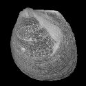
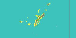
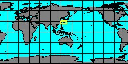
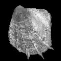
5330400254
Cosa
waikikia
(W.H. Dall, P. Bartsch
& H.A. Rehder, 1938)
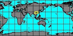
Okinawa
1,6 mm
|
|
|
|
|
|
|
|
|
|
7444000004
Cosa
wanganuica
(FOSSIL)
Finlay, 1930 †
New Zealand, North Island
|
|
|
|
|
Genus: Cratis C. Hedley, 1915 (DB: 14 SP, 3 IMG)
|
|
|
|
|
|
|
7040000032
Cratis
delicata
W. Bergmans, 1970
|
|
No Georeferenced data available
|
|
|
|
|
|
|
|
|
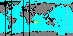
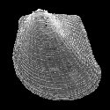
5330400258
Cratis
kanekoi
I. Hayami & T. Kase, 1993
Tuamotu, Fakarava
1,54 mm
|
|
|
|
|
|
|
|
|
|
7444000022
Cratis
miocenica
(FOSSIL)
C.R. Laws, 1936 †
|
|
No Georeferenced data available
|
|
|
|
|
|
|
|
7040000015
Cratis
ohashii
I. Hayami & T. Kase, 1993
|
|
No Georeferenced data available
|
|
|
|
|
|
|
|
7444000002
Cratis
ovata
(FOSSIL)
J. Marwick, 1931 †
|
|
No Georeferenced data available
|
|
|
|
|
|
|
|
5330400260
Cratis
pentodon
(C.G. Aguayo
& P.J. Borro, 1946)
|
|
No Georeferenced data available
|
|
|
|
|
|
|
|
7444000023
Cratis
pliocenica
(FOSSIL)
C.R. Laws, 1936 †
|
|
No Georeferenced data available
|
|
|
|
|
|
|
|
|
|
|
7040000016
Cratis
thylicus
P.G. Oliver
& A.M. Holmes, 2004
Mauritius, Rodriguez Island
|
|
|
|
|
Genus: Eophilobryoidella Stiller & Chen, 2004 † (DB: 1 SP, 0 IMG)
|
Genus: Limarca R. Tate, 1886 (DB: 4 SP, 3 IMG)
|
|
|
|
|
7444000005
Limarca
altera
(FOSSIL)
(G.P. Deshayes, 1858 †)
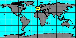
France, Paris Basin
|
|

|
|
|
|
|
|
|
|
|
7036000005
Limarca
munieri
(F. Bernard, 1896)
|
|
No Georeferenced data available
|
|
|
|
|
|
|
|
7444000006
Limarca
nana
(FOSSIL)
(G.P. Deshayes, 1829 †)
France, Paris Basin
|
|
|
|
|
Genus: Limopsilla K.H.J. Thiele, 1923 (DB: 1 SP, 0 IMG)
|
Genus: Lissarca E.A. Smith, 1879 (syn: Austrosarepta, Notolimopsis - DB: 22 SP, 4 IMG)
|
«
Previous
1
2
3
4
Next
»
|
|
| | | | |