Genus: Graphis J.G. Jeffreys, 1867 (syn: Cioniscus, Miraclis, Pseudochemnitzia, Rotfanella - DB: 26 SP, 9 IMG)
|
|
|

|
|
5350000043
Graphis
infans
(C.F. Laseron, 1951)
|
|
No Georeferenced data available
|
|
|
|
|
|
|
|
2170050018
Graphis
lightbourni
J. van der Linden
& R.G. Moolenbeek, 2004
|
|
No Georeferenced data available
|
|
|
|
|
|
|
|
|
|
|
|
5350000046
Graphis
pellucida
(J.H. Gatliff
& C.J. Gabriel, 1911)
|
|
No Georeferenced data available
|
|
|
|
|
|
|
|
2170050019
Graphis
perrierae
J.C.N. Barros & al., 2003
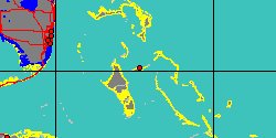
Brazil
|
|
No Georeferenced data available
|
|
|
|
|
|

|
|
6628000013
Graphis
problanda
(FOSSIL)
C.R. Laws, 1944 †
|
|
No Georeferenced data available
|
|
|
|
|
|
|
|
|
|
|
|
|
|
|
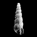
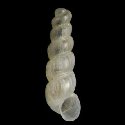
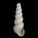
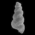
5366000167
Graphis
weissi
(FOSSIL)
Grundel, 1999 †
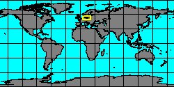
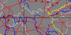
Germany, Bayern, Bamberg
|
|
|
|
|
Genus: Itiscala Maxwell, 1992 † (DB: 2 SP, 0 IMG)
|
|
|
|
|
6628000014
Itiscala
exilis
(FOSSIL)
P.A. Maxwell, 1992 †
|
|
No Georeferenced data available
|
|
|
|
|
|
|
|
6628000015
Itiscala
sodalis
(FOSSIL)
P.A. Maxwell, 1992 †
|
|
No Georeferenced data available
|
|
|
Genus: Neodonaldina Bandel, 1996 † (DB: 5 SP, 2 IMG)
|
|
|
|
|
|
|
|
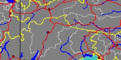
5366000171
Neodonaldina
sinuata
(FOSSIL)
J. Gründel & A. Nützel,
1998 †
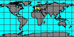
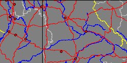
Germany, Bayern,
Wei�enburg-Gunzenhausen
|
|
|
|
|
|
Genus: Reinbergia Gründel, 2007 † (DB: 1 SP, 0 IMG)
|
Genus: Schartia Nützel & Kaim, 2014 † (DB: 1 SP, 0 IMG)
|
|
|
|
|
5366000174
Schartia
carinata
(FOSSIL)
A. Nützel & A. Kaim,
2014 †
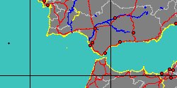
Italy, Veneto, Belluno
|
|
|
|
|
Genus: Tofanella Bandel, 1995 † (DB: 3 SP, 2 IMG)
|
|
|
Genus: Urlocella Gründel, 1998 † (DB: 1 SP, 0 IMG)
|
Genus: Usedomella Gründel, 1998 † (DB: 5 SP, 0 IMG)
|
«
Previous
1
2 Next »
|
|
| | | | | | |