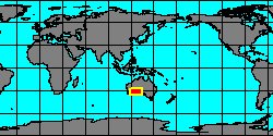
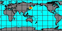
SubFamily: TAPETINAE - Subgenus: Gomphina (Jukesena) T. Iredale, 1915 (syn: Acolus - DB: 1 SP, 0 IMG)
|
|
|

|
|
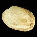
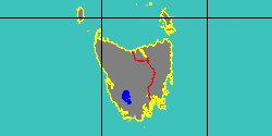
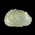
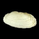
7202000059
Jukesena
foveolata
(J.E. Cooper
& H.B. Preston, 1910)
|
|
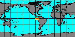
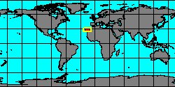
No Georeferenced data available
|
|
|
SubFamily: TAPETINAE - Genus: Irus A. Schmidt, 1818 (syn: IrusSchmidt, Notirus - DB: 12 SP, 10 IMG)
|
|
|
|

|
|
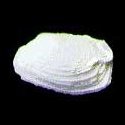
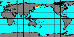
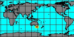
7608000335
Irus
caudex
(FOSSIL)
(C.R. Laws, 1936 †)
|
|
No Georeferenced data available
|
|
|
|
|
|
|
|
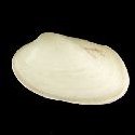
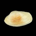
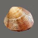
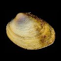
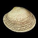
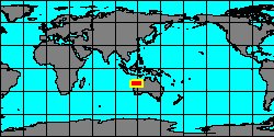
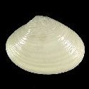
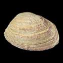
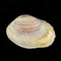
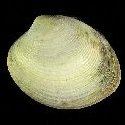
6105500000
Irus
crenatus
(J.B.P.A. Lamarck, 1818)
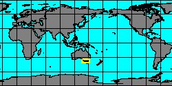
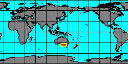
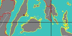
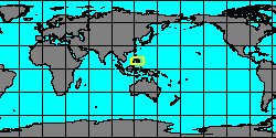
Tasmania
37,4 mm
|
|
|
|
|
|
|
|
|
|
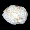
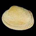
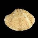
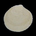
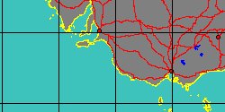
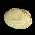
6106300005
Irus
cumingii
(G.P. Deshayes, 1854)
South Australia
38 mm
|
|
|
|
|
|
|
|
|
|
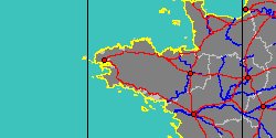
6105504015
Irus
exoticus
(J.B.P.A. Lamarck, 1818)
South Australia
34 mm
|
|
|
|
|
|
|
|
|
|
|
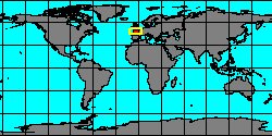
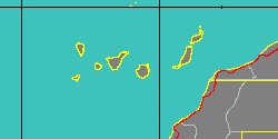
6105500015
Irus
irus
(C. Linnaeus, 1758)
Canary Islands
15 mm
|
|
|
|
|
|
|
|
|
|
|
6105500020
Irus
macrophyllus
(G.P. Deshayes, 1853)
Philippines, Calituban Island
16,2 mm
|
|
|
|
|
|
|
|
|
|
6105504005
Irus
mitis
(G.P. Deshayes, 1854)
Japan, Kotoga beach
25 mm
|
|
|
|
|
|
|
SubFamily: TAPETINAE - Subgenus: Irus (Irusella) L.G. Hertlein & U.S. Grant, 1972 (DB: 1 SP, 0 IMG)
|
SubFamily: TAPETINAE - Subgenus: Irus (Notopaphia) W.R.B. Oliver, 1923 (DB: 2 SP, 2 IMG)
|
|
SubFamily: TAPETINAE - Subgenus: Irus (Paphonotia) L.G. Hertlein & A. Strong, 1948 (DB: 2 SP, 1 IMG)
|
|
SubFamily: TAPETINAE - Genus: Katelysia A. Römer, 1857 (syn: Catelysia - DB: 10 SP, 8 IMG)
|
|
|
|
|
|
|
|
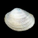
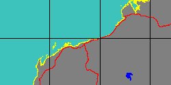
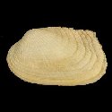
6105750005
Katelysia
neroni
(J.B.P.A. Lamarck, 1818)
Australia, Edithburgh
37,3 mm
|
|

|
|

|
|
|
|
|
|
|
|
|
|
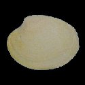
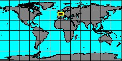
7292001519
Katelysia
texta
(FOSSIL)
(J.B.P.A. Lamarck,
1806 †)
France, Paris Basin
31 mm
|
|

|
|
|
|
SubFamily: TAPETINAE - Subgenus: Katelysia (Textivenus) A.E.M. Cossmann, 1886 † (DB: 1 SP, 1 IMG)
|
SubFamily: TAPETINAE - Genus: Legumen Conrad , 1858 † (DB: 3 SP, 0 IMG)
|
| | | | | | | |