|
|
Class: GASTROPODA
--- Taxon Tree: HETEROBRANCHIA [Subclass] - PULMONATA [Infraclass] - HYGROPHILA [Order] - LYMNAEOIDEA [Superfamily]
------ Family: LYMNAEIDAE Rafinesque, 1815 (Freshwater)
--------- SubFamily: LYMNAEINAE
------------ Genus: Sphaerogalba N.D. Kruglov & Y.I. Starobogatov, 1985
|
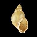
--------------- Species: Sphaerogalba bulimoides (I. Lea, 1841) - ID: 3631050005
|
|
|
|
synonyms: |
|
Bakerilymnaea bulimoides I. Lea, 1841
| |
|
Additional DB records: |
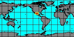
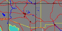
California, River Bank at Barstow
California, San Diego County, Drift, Asher Station
|
California, San Diego County, San Diego
| | |
California, San Diego County, Warner
Idaho, Craigs Mountain
|
New Mexico, Grant
| | |
New Mexico, Rio Grande Drift, Albuquerque
Oregon
|
Oregon, Brook, Oswego
| | |
Oregon, Corvalis
Oregon, In sme brook as #1491 but a little below it. Brook
|
Oregon, Stagnant pools, Corvallis
| | |
Texas, Ft Worth
|
Washington, Ellensburg, Kittitas County
| | |
|
|
------------------ Sub or form: Sphaerogalba bulimoides cockerelli (H.A. Pilsbry & J.H. Ferriss, 1906) - ID: 3631700280
|

|
|
Arizona, Chiricahua Mountains
|
|
|
|
|
|
|
Additional DB records: |
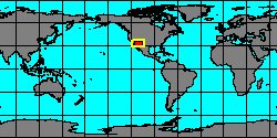
Arizona, Salt River, Tempe
Arizona, San Pedro River, 1 mile east of Benson
|
Colorado, Alamosa
| | |
Colorado, Pool S.E. of Denver,
India, Madras
|
Nebraska, Agalalla
| | |
Nebraska, Ogalalla
New Mexico, Ant hills Arroyo Pecos, Las Vegas
|
New Mexico, Las Vegas
| | |
South Dakota, Clay County, Drift, Vermillion River
South Dakota, Missouri River, Carson County
|
South Dakota, Spring Hole, East Short Pines
| | |
South Dakota, Water hole on line between Pennington County &
|
Texas, Dallas
| | |
|
|
------------------ Sub or form: Sphaerogalba bulimoides techella (S.S. Haldeman, 1867) - ID: 3631700290
|
|
|
|
Additional DB records: |
Arizona, Coconino County
Arizona, Salt River, Tempe
|
Baja California Norte
| | |
California, San Bernadino County
California, Ventura County, Bardsdale
|
California, Ventura County, Bordsdale
| | |
Mexico, Sonora
Mexico, Tamaulipas
|
Missouri, Jefferson County, Kimmswick
| | |
New Mexico, Albuquerque
New Mexico, McCorty, Valencia County
|
South Dakota, drift, Date
| | |
South Dakota, Harding County
South Dakota, Little Missouri River, Camp Crook
|
Texas
| | |
Texas, 5 mi SW of Seagoville
Texas, Bastrop County, Colorado River
|
Texas, Bellaire
| | |
Texas, Coryell County
Texas, Coryell County, E. limits of Oglesby
|
Texas, Dallas
| | |
Texas, Hays County, San Marcos
Texas, Mouth of Nueces River
|
Texas, Royse Rockwall Co
| | |
Texas, San Antonio
|
Wyoming, 10 miles east of Dubois
| | |
|
|
|